To view the slideshow, click the photo below. When it transfers you to a Picasa photo album, click the "Slideshow" button in the upper left corner.
Enjoy,
Tyler
 |
| Signage around Guatemala |
|
| Signage around Guatemala |
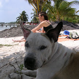 |
| You Better Belize It! |
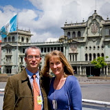 |
| POTUS Visit |

Saturday & Sunday / Guatemala City & Coban
We picked up Amy and Jason at the  toward Alta Verapaz (the region where Semuc Champey is located). We traveled for several hours by car through an extremely arid region when we detoured onto an unimproved dirt and rock road and started noticing some strange Dr. Seuss-looking flowering plants that seemed out of place in a desert climate. Then, almost instantly as we crossed a dry, dusty, rocky mountain range (crowned with the remains of a forgotten cow) fog appeared, and along with it, Spanish moss, ferns, bromeliads, and other dense vegetation. The hot dry air was suddenly replaced with cool moist air, reminiscent of the central coast of
  bromeliads than they could possibly hold, and some trees succumbed to the weight of the little squatters, falling over and sending thousands of the bromeliads spilling down the hillside. As we traveled toward the city of
Upon finally arriving to Coban, we quickly found the grooviest place in town - Hostal d'Acuña, where we had an excellent lunch and sat surrounded by orchids, wood thrushes, and ceremonial masks. Lunch was followed by scouting hotels around town for a place to sleep. However, after examining our choices, we ended up returning to the comfort and quiet of Hostal d'Acuña for the night.

Monday / Semuc Champey
The next morning we loaded up the car and headed east for Semuc Champey. Numerous low mountains and coffee farms dominated the landscape and the drive on the new and improved road was very pleasant. Eventually, we had to leave our smooth, paved road and detour onto a VERY rough, very steep road cut directly into the bedrock, which slowed us down to a few miles per hour. The slower speeds allowed us a bit more personal contact with pedestrians, who greeted us by whistling rather than waving, a custom we quickly adopted and used for the next several days.

That evening we stayed at a dumpy little backpacker-style hostal called Las Marias, where the service was friendly but the food and accommodations were grim. The big advantage of Las Marias is that it is within walking distance of an elaborate system of caves that tourists can swim through and explore, which we did that afternoon. Our tour guide was a 15 year-old who led us on a one-hour tour of the labyrinth of caves, through which a small river runs quickly and loudly, connecting great pools of water filled by underground waterfalls. During most of the tour we were able to walk up the river through the cave, but in several areas we had to swim for 20 - 50 yards until we could touch the floor again. Amy, Jason and Cris had brought little Petzl headlamps, making swimming easier, but I (Tyler) was equipped with a candle, obliging me to swim with one hand above the water or swim with two hands in the dark. There were several areas of the cave that involved climbing ladders and ropes, which we agreed would under no circumstances ever be possible in the litigious
Tuesday morning / Semuc Champey
The next morning we went about a mile to Semuc Champey National Monument, which is a bizarre system of waterfalls and hundreds of individual pools of water at the floor of a near vertical canyon. Anyone interested in geology should visit this place as there are many unusual geological features packed into a small area. We walked around for about an hour looking at steaming turquoise pools emptying into one another, and we reached an area where we could hear a lot of water moving very quickly through a small area. A park employee showed us down to a limestone shelf where we observed a large river disappearing beneath us into a smal l cave. The water was moving so quickly and violently that if you were unlucky enough to fall in, you wouldn't have to worry about drowning as you'd be instantly crushed by the rapids throwing you against the boulders. We realized that all of the pools of water we had been exploring that morning were actually directly over this massive underground river, which surfaced above ground again farther down the river valley. Before leaving Semuc Champey, we climbed up the side of the canyon to a lookout platform to get a view of the whole system from above. The whole experience was spectacular. The site is the cleanest and best-preserved that we’ve seen in
Tuesday afternoon /

We left Semuc Champey in the late morning and our next destination was Chichicastenango.
To get to Chichi, we had to travel back through Coban and then continue west on a dirt road through the Cuchumatan mountains for about 8 hours. The climate again turned hot and dry and the scenery was excellent. As we traveled through the mountains near Uspantan, we saw numerous villages with new adobe houses - many of them currently under construction. The neatly built mud-brown houses and terra-cotta roofs blended in perfectly with the green coffee farms on the valley floor and the rocky mountains in the background, creating a modest yet picturesque landscape. In our 6 months in Gautemala, Cris and I have seen many adobe buildings, but they are all old, often in disrepair, but still visually pleasing. New construction, on the other hand, is almost exclusively made with cinderblocks, which is not an aesthetically pleasing building material. Cinderblock construction dominates the contemporary Guatemalan landscape, so we were pleasantly surprised by the adobe construction in Uspantan.
Wednesday/ Chichicastenango and Xela
After driving all day through the Cuchumatan mountains and spending the night in Sa nta Cruz del Quiche, we quickly left town and made our way to Chichicastenango, a quaint little town in the western highlands famo
us for its Thursday and Sunday markets. We spent the day walking around, hanging out, and admiring the handicraft-like quilts, fabrics, masks, bags, dolls, etc. Amy and Jason scored a bedspread made of huipiles (the traditional blouses worn by Maya women) sewn together, and we all bought wooden masks, like those used in traditional Maya ceremonies.
From Chichi we drove to Xela, stopped by Cris` workto say, and then relaxed at home where we cooked and ate.
Thursday/
 Sololá market, possibly the most colorful place I've ever been due to the men and women dressed in traditional traje, but we escaped without spending any money.
 With the trunk of our car stuffed with blankets, we drove onward to
http://www.casasantodomingo.com.gt/english/index.html - navigate by clicking the arrows under the photo). The hotel structure is a converted convent and the property occupies about 3 city blocks, which includes many gardens, a candle-making shop, a pottery shop, an art gallery, and a museum. In keeping with the tradition of a convent, at dusk a man with censer walked through all of the buildings spreading the smell of incense, and the staff lit several thousand candles throughout the hotel grounds, giving the whole place a peaceful ambiance. We ended Amy & Jason's last night with a pleasant dinner at the hotel restaurant.
Saturday/ The Return Home

The next morning, Amy and Jason caught a shuttle to the airport in
and I drove back to Xela along the coast road. It was tough saying goodbye to such good friends and fellow travelers. We’ll have to wait until July, when we’re back in the


During
 we were rewarded with incredible views of the neighboring volcanoes and an intimate look down into Chicabal’s crater. After eating lunch up top at the volcano’s mirador, we descended the four hundred or so steps down to Chicabal’s lagoon and beach. Lester, our Guatemalan guide, explained that the lagoon is a sacred site (therefore no swimming allowed) where many Maya come to perform traditional ceremonies. He told the following story of what makes Chicabal a traditional site: In the past, the lagoon

now found in Chicabal’s crater once was located closer to Xela. The lagoon was fed by the rains, and the lagoon, in return, sustained the people. However, the god that lived in the
lagoon became angry over time as the local population littered the lagoon with their trash, human waste, and detergents from washing. As a result, the story goes, the lagoon dried up and was no longer. The Maya walked the surrounding hills and valleys until many
years later they found where the god had taken their original water source – to the crater of Volcan Chicabal. To this day it remains a protected and well preserved area. We could have spent the whole weekend lying on the warm sands of the quiet beach surrounding the lagoon.
Momostenango

The weekend before

Ana Laura, Tyler, and Alejandra explore the sandstone pillars. 


Momostenango means “the place of the altars”, which may be a nod to Momos strict adherence to Maya tradition. Momos sits atop a hill forested with pine trees and is home to many sheep. For hundreds of years the local Maya population has formed their own type of cooperative through which they care for the pine trees that blanket the hill top, knowing that the trees are necessary to their survival. The wool from the sheep is used to make beautiful rugs, scarves, and blankets, decorated very simply or with elaborate quetzal bird designs. We spent our time in Momos climbing and exploring Los Riscos, the sandstone pillars located on the northern edge of town. We ended the day by drinking hot chocolate and eating fondue at a Swiss-owned restaurant set atop Cerro Candelario, overlooking the city. The hot chocolate was excellent and went well with the light rain that began to fall that night.


 The first two weeks of my Dad’s stay in
  a (or trip) de
  The bruises from our sardine can-ride were quickly forgotten as 15 minutes just past the Honduran border we were met by the very friendly people of the small town Copán Ruinas. We were immediately charmed by the smiling faces of young kids; the cobblestone streets; impressive, tropical plants; red-
 tiled roofs; absence of trash; and excellent food. We immediately decided we’d be staying longer than we had originally planned, just as our guidebook warned might happen.
The small town of
We learned that Copán’s location in a long broad valley made it quite suitable as a site to build a city. The small river running through the valley floods during the rainy season and brings nutrients to the flat valley  floor, perfect for growing crops. Also, the two nearby outcroppings of stone in the surrounding hills made for excellent quarries. Sometime around 100 AD construction at Copán began, only later to be abandoned in the 9th century AD. The best guesses as to why the Maya abandoned the city include over development, over-exploitation of resources, and war. (Again, another opportunity for us to learn from history.) If you’re in the neighborhood, Copán is not to be missed.
After our two-day stay in  Chiquita Banana) exported its goods to the
  long enough for my Dad to use the restroom at the brothel I accidentally escorted him to and to take the 30 minute ferry ride to Livingston, a coastal town only accessible by boat.
Livingston (population 6,000) is an interesting little town on the
 h Belize and the Caribbean Islands than with Guatemala. The Garifuna are ethnically a mix of African, Carib, and Arawak peoples and their language is today a mix of Arawak, Carib, French, English and Spanish. The Garifuna men and women use distinct dialects of the same language, which may be a result of pre-Columbian ethnic wars in which the males of the losing side were dispatched and the women were taken as captives and later companions by the victors.
The obvious cultural differences that you see walking around town are the slower pace of life and the music. Reggae, punta, and soka music displace synthesized merengue and traditional marimba ensembles that are ubiquitous in the rest of Guatemala. The main tourist activities in town are eating and chilling out.
While in
Our fi rst day on the beach we spent listening to the rain pound the palm roof of our cabaña, which deafened the sound of the Caribbean Sea lapping on shore just 20 feet in front of us. The following day the clouds broke, the sun filled the sky, and we hiked north along the beach to Siete Altares (Seven Altars). Siete Altares aptly describes a nearby river that runs out over smoothed, limestone rocks, turning into a series of waterfalls and shallow pools. It was a treacherous hike for
  As the three of us walked there from our resort, we avoided the crowds that often arrive to Siete Altares by boat together from downtown
Obviously they have learned from previous tourists that if they stand long enough to pose, they will be awarded with a glimpse of themselves on the playback screen of the digital cameras. I did, however, have to draw a line in the sand to prevent the kids from continually moving too close to the camera’s lens. J I learned this trick from our friends Mark and Bev with whom I sailed to
In the evening, as the temperature inside our cabaña rose, Tyler and I took our pillows and sheets outside, set up a couple of the resort lounge chairs on the water’s edge and went to sleep to the gentle rolling of the shore onto the beach. We moved back in to our cabaña only as the rain of the days before returned.
 The next day we arranged for a boat-taxi to take us from our cabin on the sea back to
  As we wondering how we were going to pay the lanchero, Carlos, the Argentinian owner of the jungle eco-resort Finca Tatín, the next resort where we would stay, pulled up to the dock. As he was there to retrieve us, we explained to him our situation, and he quickly lent us the money to pay the lanchero and to get a cup of coffee while he did some grocery shopping before returning to the finca.
 Having paid our debt and filled up the small boat with provisions, we all climbed in and turned south up the Río Dulce. Although it began to rain on us in our open “lancha”, we hardly noticed as we were captivated by the numerous birds and 300 feet high, vertical canyon walls that surrounded us as we motored toward the finca. Upon our arrival to Finca Tatín (http://www.fincatatin.centramerica.com/mainE.htm), we immediately knew we were going to like this place. Tyler, my Dad, and I were assigned a comfortable, quaint cabin right on the river’s edge, with a complete bathroom and single bed downstairs for my Dad and a double bed upstairs for me and Tyler. All over the swampy ground of Finca Tatin - around our cabin, around the common areas, etc. - there were thousands of tiny blue crabs slowly crawling around and threatening each other with their 1” long claws.
 The common area at the resort was filled with hammocks, books for trade, and handmade scrabble, backgammon, and chess boards. The menu listed good, healthy options for breakfast and lunch while dinner was communal, bringing everyone at the resort together at one table. Everything eaten or enjoyed at the resort was based on an honor system.
 The resort kept a book in which each guest had his or her own page where one kept track of one’s meals, drinks, kayak trips, etc. At the end of the stay, one’s total was added and then paid. We added a couple nights stay, a kayak trip to the Biotopo Chocón Machacas (a government protected manatee reserve), and a couple of T-shirts to our tab before moving on up river to the town of
  orthwest to the town of
Flores, the town nearest to  as we quickly learned there were no ATM machines in
On our second day in  can/mini-van to
 Our third day in Peten (the northern Guatemalan state or “department” where
 Our next destination from Peten was the old colonial city (and former capital of
  Suddenly we came over a mountain range and the orange-yellow lights of
We woke up in  best day for pastry hunting as many shops were closed; however, we were able to find some acceptable cheesecake and cappuccinos.
On Christmas Day we had lunch at the Swiss owned Mesón Panza Verde. The three of us agreed that this was the most significant culinary experience we’d had in a long time.  we knew we were in for a culinary treat. My Dad and I went for the traditional turkey dinner with mashed potatoes– the best I’ve ever had (sorry mom!).
As we walked off our lunch around town, we happened upon a Christmas parade. We were enjoying the antics of the masked parade-goers and marimba players so much that we followed them for a couple of blocks. Later in the evening, Tyler and I went out in search of dessert and came upon a fusion Thai restaurant called Café Flor. We enjoyed the live piano music that was playing, but I was a little put off by my chocolate brownie made from corn flour, and we were both put off by the host/pianist’s peddling of music CDs at our table when the bill came.
 On December 26th, we headed back to Xela from


